
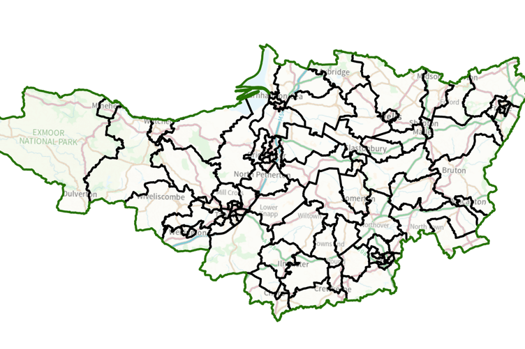
A NEW political map of the West Somerset area was published by the Local Government Boundary Commission (LGBC) on Tuesday (March 3) showing the areas Somerset councillors will represent from the next elections in May, 2027.
The commission wants as many single-councillor divisions as possible, but accepted urban Minehead could continue to share two members to avoid creating unnecessary confusion for residents.
Watchet and Williton will share a single councillor, while there will also be one member for a Quantock Vale division covering from Sampford Brett to Steart and including Nether Stowey, one for Lydeard and Stogumber which stretches from Bishops Lydeard through Crowcombe and Stogumber to just short of Bicknoller, and another for Cannington and its surrounding villages.
The Somerset side of Exmoor has been split into east and west, with one councillor for the large and sparsely populated section running from the Devon border to Dulverton and north through Timberscombe to the coast.
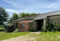 Driver Farm restoration to have flexible Exmoor education centre & semi-wild camping
.jpeg?width=209&height=140&crop=209:145,smart&quality=75) Vital role of women on Exmoor estate to be celebrated by National Trust
Vital role of women on Exmoor estate to be celebrated by National Trust Minehead resort to stage fireworks & laser show as Butlin's celebrates 90th birthday
 See the latest planning applications in West Somerset and Exmoor
A new division, Brendon Hills and Coast, covers the coastal area between Minehead and Watchet south through Carhampton and Monksilver to Huish Champflower and Clatworthy and also including Brompton Regis and Brompton Ralph.
Wiveliscombe will form one large rural division taking in also Milverton and most of what are known as the ‘10 Parishes’.
The number of unitary councillors across Somerset will be cut from 110 to 96, each representing about 4,867 electors.
The changes will become law once Parliament has approved them.
Commission chairman Bev Smith said: “We are very grateful to people in Somerset.
“We considered all the comments they gave us on our recommendations for a new electoral map for the area and this has helped us to make changes.
“We believe the new arrangements will deliver electoral fairness while reflecting the needs and identities of local communities.”
Comments
This article has no comments yet. Be the first to leave a comment.