
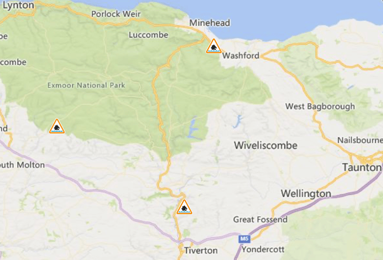
STORM warnings have been issued by the UK’s Met Office for the West Somerset and Wellington areas from Monday evening (December 8).
Two yellow weather warnings cover the area, the first for heavy rain starting at 6 pm on Monday and lasting until 6 pm on Tuesday.
The second is for wind and takes effect at 10 pm on Monday and continues until 4 pm on Tuesday.
Gusts of wind are expected to reach 40 to 50 mph (64 to 80km/h) across many areas, while rainfall could see two to three inches (50 to 75 mm) and up to 3.9 inches (100 mm) possible on higher ground.


The Environment Agency has also issued flood alerts for rivers on Exmoor and in the Culm Valley and the Blackdown Hills.
Storm Bram, which has been named by Met Eireann, Ireland's equivalent of the Met Office, is expected to develop rapidly on Tuesday, clearing away to the north-east during the day but with rain and strong winds likely to continue into Wednesday.
Met Office chief forecaster Dan Suri said: “Storm Bram will bring a very wet and windy spell of weather, with very strong winds and further heavy rain which falling over saturated ground, could cause flooding impacts.
“More widely, gusts of 50 to 60 mph, and perhaps 70 mph in a few spots, are expected across Wales, South West England, and Northern Ireland.
“Rain is an additional impact from Storm Bram, with the possibility of 100 mm over higher ground in the south of Wales and parts of Devon.
“This could require updates to warnings, so it is important to stay up to date with the forecast in your area, as well as any flood warnings from your local environment agency.”
A yellow weather warning means there is a slight chance of power cuts and loss of other services to some homes and businesses, and they could also be flooded, causing damage to some buildings
Fast flowing or deep floodwater is possible, causing a danger to life.
Delays or cancellations to train and bus services are possible and spray and flooding could lead to difficult driving conditions and some road closures, with a risk of some communities becoming cut off by flooded roads.
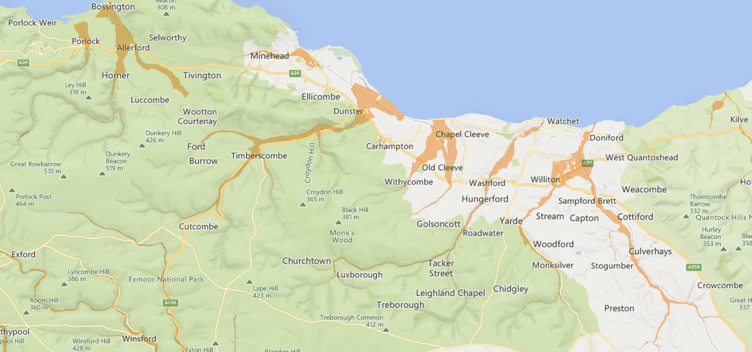
An Environme t Agency spokesperson said: “River levels have fallen on most rivers in West Somerset, but remain high on the Washford River, which is still above the flood alert level.
“A band of heavy persistent rain is forecast from Monday evening through to about mid-day tomorrow, which will cause flooding impacts and sustain this alert.
“The Washford River, and other rivers in the area are forecast to rise.
“Flooding is possible on low lying land and roads near the Horner Water, River Aller, Washford River, and the Hawkcombe, Monksilver, and Doniford streams and tributaries.

“Drier weather is forecast on Wednesday and Thursday.
“We will continue to monitor the situation and will issue further alerts or warnings if necessary.
“We are checking defences and clearing bridges, culverts, and screens where necessary.
“Continue to take care on waterside roads and footpaths and do not put yourself in unnecessary danger.
“Keep checking for updates to these alerts.”
On Exmoor, the main areas of concern were Lynton, Lynmouth, Challacombe, Meethe, South Molton, Dulverton, Brushford, Winsford, Exton, and Exford.
Flooding was possible on the upper River Exe from Exford to Exebridge, the Rivers Barle, Lyn, Mole, and Bray, and their tributaries, and the middle River Exe from Exebridge to Tiverton, and the Rivers Haddeo, Batherm, and Lowman.
The agency spokesperson said: “We are monitoring rainfall and river levels and will issue flood warnings if needed.
“Take care and avoid walking, cycling, or driving through flood water.”
The River Tone catchment area is also on alert from Clatworthy Reservoir to Currymoor, the Hillfarrance Brook, the Halsewater Stream, and other Tone tributaries.
The agency spokesperson said: “A band of heavy persistent rain is forecast from Monday evening through to about mid-day on Tuesday, which may cause flooding impacts on Tuesday morning and through the day.
“Locations most affected will be low lying land and roads near rivers.
“Areas most at risk include roads around Hillfarrance and Bradford on Tone.
“Bradford on Tone ring banks will be bank full.
“Drier weather is forecast on Wednesday and Thursday and the situation should improve.”
In the Culm Valley and Blackdown Hills the main areas of concern included Culmstock and Hemyock, with forecasts suggesting there could be flooding on low lying land and roads close to rivers from about 11 pm on Monday.
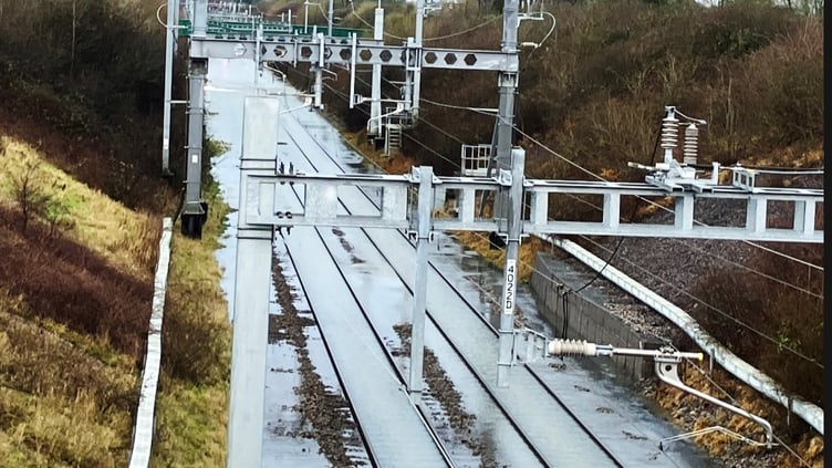
Great Western Railway (GWR) is warning customers it expects flooding to significantly affect services and is allowing tickets for Tuesday to be used on Wednesday, December 10, instead.
GWR will run a reduced train service because of the conditions, with flooding likely to cause significant disruption or delays.
There is also an increased risk of falling trees and other debris from high winds as the storm moves across the region, which can impact the safe operation of trains.
GWR will provide updates throughout the day and is encouraging customers to amend their plans, and to check before they travel if they must make a journey.
Comments
This article has no comments yet. Be the first to leave a comment.