
A TOTAL of 24 potential housing sites with employment land have been earmarked in West Somerset's three key settlements to meet the demand to build 2,500 new homes over the next 20 years.
But some of the sites - which are all expected to deliver a minimum of 250 homes and two hectares of employment land - in the new West Somerset draft local plan proposals are likely to spark controversy.
West Somerset Council's local development panel this week recommended that a total of seven sites in the Minehead area and a further three in Dunster Marsh should go into the melting pot.
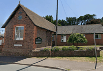 Public meeting will discuss support for Kilve community shop committee's plans
 See the latest planning applications and decisions across West Somerset
 New funding sees expansion across Somerset of Fixy electrical recycling project
 Council spending near-£6 million on street lighting conversion to LED bulbs
In Williton a possible eight sites have been put forward, with a further six identified in Watchet.
The proposed locations will have to be ratified by the council's cabinet and full council before the public and a range of stakeholders have the chance to give their views.
The Minehead sites include just under five hectares at Mount Brake, east of the Porlock Road, more than 26 hectares south of the A39 between Middlecombe Cross and west of Periton Cross and just under 33 hectares between Periton Cross and Higher and Lower Hopcott.
Almost 55 hectares between Lower Hopcott and Chestnut Way/Staunton Road and around three hectares on the site of Minehead's rugby club and land to the south of it are also included.
The other Minehead locations are 21 hectares of land north and east of Seaward Way to the west of the West Somerset Railway and just over 14 hectares to the east of Seaward Way, north of the A39 and west of Drift Road.
Councillors had previously earmarked just three sites in Minehead but overturned proposals that came out of a special seminar in August to widen the scope.
They also decided to include all the sites put forward for Williton and Watchet, despite officers asking them to identify their preferred options and being warned that failure to do so would be likely to delay the local plan process.
Just one of four sites suggested in the Dunster Marsh area was thrown out - more than 29 hectares between the old River Avill, the West Somerset Railway and the River Avill flood and relief channel - because of its good agricultural quality.
However, almost 20 hectares north of Marsh Lane and west of Station Road, just over three hectares south of Marsh Lane and nearly four hectares between Station Road and Sea Lane have been included.
In Williton, just under six hectares of land south of the A39, almost ten hectares on the eastern edge overlooking the Doniford Stream and more than eight hectares on the western edge of land bounded by Catwell to the north and Tower Hill Quarry to the south have been identified as possible sites.
Other locations in Williton include nearly 13 hectares of land to the north of the A358 and eastern edge of Tower Hill, more than 11 hectares north of Williton's two schools and west of Liddymore Road and just under 12 hectares north of the Roughmoor Industrial estate between Liddymore Lane and the West Somerset Railway.
More than 30 hectares behind Mamsey House to the north of the A39 and just under ten hectares at The Bury, north of Bridge Farm are also in the Williton sites.
In Watchet, the Parsonage Farm complex in Brendon Road has been put forward as a possible site, along with a further 16 hectares to the east and north of the farm.
Other areas include just under six hectares north of Doniford Road and the West Somerset Railway, almost 16 hectares south of Doniford Road and north of Normandy Road, nearly eight hectares between Normandy Road and Liddymore Lane and almost nine hectares south east of Liddymore Road.
Local development plan officer Martin Wilsher told councillors there were flood risk and other constraints on some of the sites but some or all of those identified could potentially be developed.
"What we are trying to do is second guess and get people to give us the reasons why they don't feel sites should be developed," he said.
"Until you do something - controversial as it might seem - it's difficult for people to comment."
Mr Wilsher said the council was not saying whole areas should be allocated but any site developed should be able to become a self contained community in its own right, with enough land for shops, community halls and open space.
He said the aim of the local plan was to try and create opportunities for people to work, rest and play.
"The reality is that if something is more than 200 yards away people will not walk, they will get in the car."
Councillors told officers at this week's meeting they were unhappy about choosing preferred areas for potential development in Watchet and Williton because they did not know them sufficiently well.
Mr Wilsher admitted it was a challenge to find land for 2,500 new homes over the next 20 years.
But he warned that was a conservative figure, which would, in effect, become a rolling figure: "And probably a minimum rolling figure," he added.
"All we are trying to do is manage where development goes," he said.
Mr Wilsher said it was even more important to produce a new local plan as quickly as possible in light of the Government's intention to relax planning policies.
"This is not a final version - you are not having to make a decision that is cast in stone, just one that will give the possible direction of growth over the next 20 years so that we can consult on it."
Comments
This article has no comments yet. Be the first to leave a comment.