

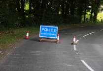
AN Exmoor road has been named as one of the UK's darkest, most dangerous roads in a survey using data from motoring organisation the Automobile Association (AA).
Porlock Hill is already recognised as the steepest A road in the UK and the scene of many accidents, some of which have been fatal.
Now, it has been analysed by Right Fuel Card using AA crash data and light pollution levels measured using the Bortle scale, a nine-level measure of night sky brightness.
This placed it fifth in a list of roads in the UK which posed the greatest risk to motorists, with a Bortle ranking of 4.1, equal with the infamous A496 in Snowdonia.
 Repairs to A396 Cutcombe Hill moved to nighttime work to avoid Snowdrop Valley clash
 Don't be caught out by festive changes to West Somerset recycling & waste collections
 £1.5k raised for good causes as hundreds join Exmoor farming community carol service
 Public Notices: Emergency closure of footbridge
 AA data shows this time of year is the most dangerous for motorists across the UK, with collisions rising by 11 per cent in the two weeks following the clocks going back, compared to the fortnight before.
Right Fuel Card chief executive Matthew Briggs said: “Light pollution across the south is particularly bad due to the area's close connections with London and South Wales.
“However, Exmoor National Park is one of the only regions of the south to have extremely low light pollution levels.
“This does mean an increased level of risk.
“Porlock Hill, which connects Porlock to Lynmouth, in Devon, is particularly unsafe.
“Alongside being the steepest A road in the UK, constant crashes have led residents to campaign for a lower speed limit, better signage, and updated road markings.
“Areas of the country with low levels of light pollution are some of the most beautiful, giving us incredible views of the night sky.
“However, for drivers, this lack of light reduces visibility, increasing the risk of a collision.
“Since the clocks have gone back, the shorter days and longer nights mean that winter is truly upon us.”
Comments
This article has no comments yet. Be the first to leave a comment.